
Thank you for supporting this site ❤️
Make a donation
Make a donation
Zieckau topographic map
Click on the map to display elevation.
Thank you for supporting this site ❤️
Make a donation
Make a donation
About this map
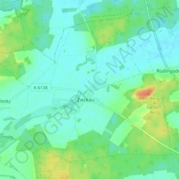
Name: Zieckau topographic map, elevation, terrain.
Location: Zieckau, Luckau, Dahme-Spreewald, Brandenburg, Deutschland (51.87773 13.61108 51.91283 13.68144)
Average elevation: 71 m
Minimum elevation: 60 m
Maximum elevation: 97 m
Thank you for supporting this site ❤️
Make a donation
Make a donation
Other topographic maps
Click on a map to view its topography, its elevation and its terrain.