
Thank you for supporting this site ❤️
Make a donation
Make a donation
Racine topographic map
Click on the map to display elevation.
Thank you for supporting this site ❤️
Make a donation
Make a donation
About this map
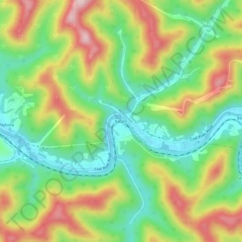
Name: Racine topographic map, elevation, terrain.
Location: Racine, Boone County, West Virginia, 25165, United States (38.12205 -81.68040 38.16205 -81.64040)
Average elevation: 318 m
Minimum elevation: 195 m
Maximum elevation: 489 m
Thank you for supporting this site ❤️
Make a donation
Make a donation
Other topographic maps
Click on a map to view its topography, its elevation and its terrain.