
Offley Hoo topographic map
Click on the map to display elevation.
About this map
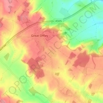
Name: Offley Hoo topographic map, elevation, terrain.
Average elevation: 134 m
Minimum elevation: 78 m
Maximum elevation: 175 m
Other topographic maps
Click on a map to view its topography, its elevation and its terrain.
Long Pond
United Kingdom > England > Hertfordshire > North Hertfordshire > Offley > Offley Hoo
Average elevation: 142 m