Geolocate
👉 Easily get elevation data in JSON, GeoTIFF and KML formats using Elevation API
Thank you for supporting this site ❤️
Make a donation

Linderbach topographic map

Click on the map to display elevation.

👉 Easily get elevation data in JSON, GeoTIFF and KML formats using Elevation API
Thank you for supporting this site ❤️
Make a donation

About this map

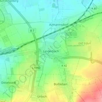
Name: Linderbach topographic map, elevation, terrain.

Location: Linderbach, Erfurt, Thuringia, 99098, Germany (50.95898 11.08060 50.99898 11.12060)

Average elevation: 225 m

Minimum elevation: 195 m

Maximum elevation: 289 m

Other topographic maps

Click on a map to view its topography, its elevation and its terrain.

Alach

Germany > Thuringia > Erfurt

Average elevation: 298 m

Bindersleben

Germany > Thuringia > Erfurt

Average elevation: 298 m