
Thank you for supporting this site ❤️
Make a donation
Make a donation
Gesotz topographic map
Click on the map to display elevation.
Thank you for supporting this site ❤️
Make a donation
Make a donation
Gesotz
Sehenswert ist in Gesotz eine ca. 200 Jahre alte Roteiche mit einer Höhe von rund 20 m. Der Baum gehört als Naturdenkmal zur Ortsgemeinde Lascheid.
Thank you for supporting this site ❤️
Make a donation
Make a donation
About this map
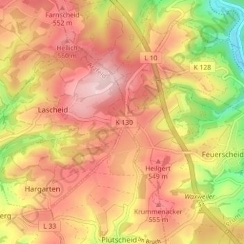
Name: Gesotz topographic map, elevation, terrain.
Average elevation: 499 m
Minimum elevation: 358 m
Maximum elevation: 591 m
Thank you for supporting this site ❤️
Make a donation
Make a donation