
Roldán topographic map
Interactive map
Click on the map to display elevation.
About this map
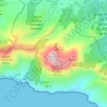
Name: Roldán topographic map, elevation, terrain.
Location: Roldán, Cartagena, Región de Murcia, 30394, España (37.58916 -1.04037 37.58926 -1.04027)
Average elevation: 148 m
Minimum elevation: 0 m
Maximum elevation: 480 m