
Thank you for supporting this site ❤️
Make a donation
Make a donation
Rada topographic map
Click on the map to display elevation.
Thank you for supporting this site ❤️
Make a donation
Make a donation
About this map
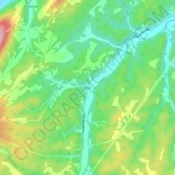
Name: Rada topographic map, elevation, terrain.
Location: Rada, Hampshire County, West Virginia, 26852, United States (39.25399 -78.93336 39.29399 -78.89336)
Average elevation: 304 m
Minimum elevation: 234 m
Maximum elevation: 426 m
Thank you for supporting this site ❤️
Make a donation
Make a donation
Other topographic maps
Click on a map to view its topography, its elevation and its terrain.