
Morne Jean topographic map
Interactive map
Click on the map to display elevation.
About this map
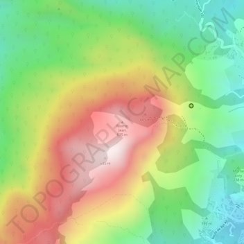
Name: Morne Jean topographic map, elevation, terrain.
Average elevation: 341 m
Minimum elevation: 33 m
Maximum elevation: 679 m
Son sommet culmine à 718 mètres d'altitude.
Other topographic maps
Click on a map to view its topography, its elevation and its terrain.
Rivière du Haut-du-Cap
Haïti > Département du Nord > Commune Cap-Haïtien
Rivière du Haut-du-Cap, Commune Cap-Haïtien, Arrondissement de Cap-Haïtien, Département du Nord, Haïti
Average elevation: 90 m
Commune Cap-Haïtien
Haïti > Département du Nord > Commune Cap-Haïtien
Commune Cap-Haïtien, Arrondissement de Cap-Haïtien, Département du Nord, Haïti
Average elevation: 100 m