
Thank you for supporting this site ❤️
Make a donation
Make a donation
Unterkirnach topographic map
Click on the map to display elevation.
Thank you for supporting this site ❤️
Make a donation
Make a donation
About this map
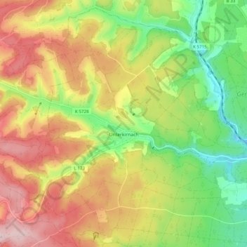
Name: Unterkirnach topographic map, elevation, terrain.
Average elevation: 859 m
Minimum elevation: 733 m
Maximum elevation: 996 m
Thank you for supporting this site ❤️
Make a donation
Make a donation
Other topographic maps
Click on a map to view its topography, its elevation and its terrain.
Hohe Mark
Duitsland > Baden-Württemberg > Schwarzwald-Baar-Kreis > Villingen-Schwenningen
Average elevation: 757 m