
Thank you for supporting this site ❤️
Make a donation
Make a donation
Luleå topographic map
Click on the map to display elevation.
Thank you for supporting this site ❤️
Make a donation
Make a donation
About this map
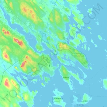
Name: Luleå topographic map, elevation, terrain.
Location: Luleå, Luleå kommun, Norrbotten County, 971 28, Sweden (65.42312 21.98595 65.74312 22.30595)
Average elevation: 11 m
Minimum elevation: -3 m
Maximum elevation: 139 m
Thank you for supporting this site ❤️
Make a donation
Make a donation