
Thank you for supporting this site ❤️
Make a donation
Make a donation
McCausland topographic map
Click on the map to display elevation.
Thank you for supporting this site ❤️
Make a donation
Make a donation
About this map
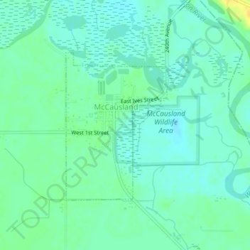
Name: McCausland topographic map, elevation, terrain.
Location: McCausland, Scott County, Iowa, 52758, United States (41.73536 -90.45181 41.75135 -90.43715)
Average elevation: 185 m
Minimum elevation: 177 m
Maximum elevation: 200 m
Thank you for supporting this site ❤️
Make a donation
Make a donation
Other topographic maps
Click on a map to view its topography, its elevation and its terrain.