
Pendeen topographic map
Click on the map to display elevation.
About this map
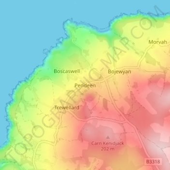
Name: Pendeen topographic map, elevation, terrain.
Location: Pendeen, St Just, Cornwall, England, TR19 7DN, United Kingdom (50.13133 -5.68528 50.17133 -5.64528)
Average elevation: 99 m
Minimum elevation: 0 m
Maximum elevation: 223 m
Other topographic maps
Click on a map to view its topography, its elevation and its terrain.