
Thank you for supporting this site ❤️
Make a donation
Make a donation
Perasing topographic map
Click on the map to display elevation.
Thank you for supporting this site ❤️
Make a donation
Make a donation
About this map
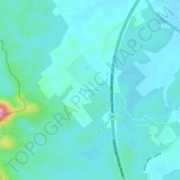
Name: Perasing topographic map, elevation, terrain.
Location: Perasing, Kemaman District, Terengganu, Malaysia (3.94633 103.27015 3.98633 103.31015)
Average elevation: 42 m
Minimum elevation: 16 m
Maximum elevation: 213 m
Thank you for supporting this site ❤️
Make a donation
Make a donation
Other topographic maps
Click on a map to view its topography, its elevation and its terrain.
Thank you for supporting this site ❤️
Make a donation
Make a donation
Sungai Kandang Rusa
Malaysia > Terengganu > Kemaman District > Kampung Semayor
Average elevation: 32 m