
Ajegunle topographic map
Interactive map
Click on the map to display elevation.
About this map
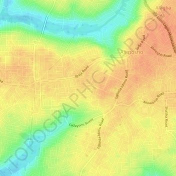
Name: Ajegunle topographic map, elevation, terrain.
Location: Ajegunle, Alimosho, Lagos, Nigeria (6.58311 3.26525 6.62311 3.30525)
Average elevation: 35 m
Minimum elevation: 9 m
Maximum elevation: 49 m