
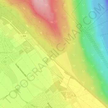
Niederzierer See topographic map
Interactive map
Click on the map to display elevation.
About this map
Name: Niederzierer See topographic map, elevation, terrain.
Average elevation: 100 m
Minimum elevation: -60 m
Maximum elevation: 202 m
Other topographic maps
Click on a map to view its topography, its elevation and its terrain.
Schloss Hambach
Deutschland > Nordrhein-Westfalen > Kreis Düren > Hambach
Schloss Hambach, 117, Schlossstraße, Hambach, Niederzier, Kreis Düren, Nordrhein-Westfalen, 52382, Deutschland
Average elevation: 106 m