
Make a donation
Chad Lake topographic map
Click on the map to display elevation.
Make a donation
About this map
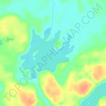
Name: Chad Lake topographic map, elevation, terrain.
Average elevation: 441 m
Minimum elevation: 426 m
Maximum elevation: 466 m
Make a donation
Other topographic maps
Click on a map to view its topography, its elevation and its terrain.
Chris Lake
United States > Minnesota > Saint Louis County > Pequaywan Township
Average elevation: 494 m
Embarrass
United States > Minnesota > Saint Louis County > Embarrass Township
Average elevation: 438 m
Make a donation
Echo River
United States > Minnesota > Saint Louis County > Northeast St Louis
Average elevation: 393 m
Make a donation
Embarrass
United States > Minnesota > Saint Louis County > Embarrass Township
Average elevation: 438 m
Central Lakes
United States > Minnesota > Saint Louis County > Ellsburg Township
Average elevation: 408 m
Make a donation
Make a donation
Virginia
United States > Minnesota > Saint Louis County > Virginia > Virginia
Average elevation: 467 m
Make a donation