
Lake Superior topographic map
Interactive map
Click on the map to display elevation.
About this map
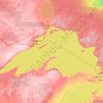
Name: Lake Superior topographic map, elevation, terrain.
Location: Lake Superior, Michigan, USA (46.41024 -92.27277 49.01868 -84.35438)
Average elevation: 317 m
Minimum elevation: 94 m
Maximum elevation: 661 m
Other topographic maps
Click on a map to view its topography, its elevation and its terrain.