
Thank you for supporting this site ❤️
Make a donation
Make a donation
Big Windy topographic map
Click on the map to display elevation.
Thank you for supporting this site ❤️
Make a donation
Make a donation
About this map
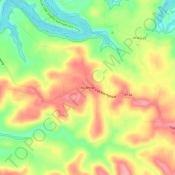
Name: Big Windy topographic map, elevation, terrain.
Location: Big Windy, Hart County, Kentucky, 42729, United States (37.29866 -86.11442 37.33866 -86.07442)
Average elevation: 206 m
Minimum elevation: 148 m
Maximum elevation: 259 m
Thank you for supporting this site ❤️
Make a donation
Make a donation
Other topographic maps
Click on a map to view its topography, its elevation and its terrain.