
Thank you for supporting this site ❤️
Make a donation
Make a donation
Over-the-Rhine topographic map
Click on the map to display elevation.
Thank you for supporting this site ❤️
Make a donation
Make a donation
About this map
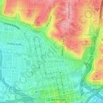
Name: Over-the-Rhine topographic map, elevation, terrain.
Average elevation: 196 m
Minimum elevation: 143 m
Maximum elevation: 271 m
Thank you for supporting this site ❤️
Make a donation
Make a donation
Other topographic maps
Click on a map to view its topography, its elevation and its terrain.
Thank you for supporting this site ❤️
Make a donation
Make a donation
Norwood Heights
United States > Ohio > Hamilton County > Cincinnati > Norwood Heights
Average elevation: 207 m
Thank you for supporting this site ❤️
Make a donation
Make a donation