
Thank you for supporting this site ❤️
Make a donation
Make a donation
Mont Owl's Head topographic map
Click on the map to display elevation.
Thank you for supporting this site ❤️
Make a donation
Make a donation
About this map
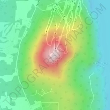
Name: Mont Owl's Head topographic map, elevation, terrain.
Location: Mont Owl's Head, Potton, Memphrémagog, Quebec, Canada (45.06217 -72.29808 45.06227 -72.29798)
Average elevation: 370 m
Minimum elevation: 193 m
Maximum elevation: 733 m
Thank you for supporting this site ❤️
Make a donation
Make a donation