
Thank you for supporting this site ❤️
Make a donation
Make a donation
Logan topographic map
Click on the map to display elevation.
Thank you for supporting this site ❤️
Make a donation
Make a donation
About this map
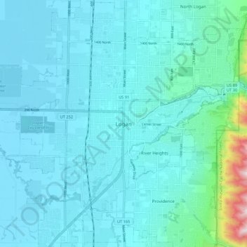
Name: Logan topographic map, elevation, terrain.
Location: Logan, Cache County, Utah, 84321, United States (41.69134 -111.87486 41.77134 -111.79486)
Average elevation: 1,419 m
Minimum elevation: 1,347 m
Maximum elevation: 2,032 m
Thank you for supporting this site ❤️
Make a donation
Make a donation