
Thank you for supporting this site ❤️
Make a donation
Make a donation
Schafberg topographic map
Click on the map to display elevation.
Thank you for supporting this site ❤️
Make a donation
Make a donation
Schafberg
Die Ibbenbürener Bergplatte, häufig auch als Schafberg, Schafbergplatte oder Schafbergmassiv bezeichnet, ist ein maximal 176,1 m ü. NHN hoher Höhenzug aus horstartig herausgehobenem Karbon im Tecklenburger Land (Kreis Steinfurt) nördlich von Ibbenbüren in Nordrhein-Westfalen (Deutschland), der zum Osnabrücker Hügelland gehört.
Thank you for supporting this site ❤️
Make a donation
Make a donation
About this map
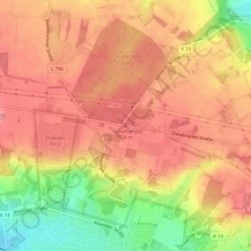
Name: Schafberg topographic map, elevation, terrain.
Average elevation: 144 m
Minimum elevation: 77 m
Maximum elevation: 178 m
Thank you for supporting this site ❤️
Make a donation
Make a donation