
Thank you for supporting this site ❤️
Make a donation
Make a donation
Rehain topographic map
Click on the map to display elevation.
Thank you for supporting this site ❤️
Make a donation
Make a donation
Rehain
Vor dem Wiener Kongress und den dort beschlossenen Gebietsabtretungen des Königreiches Sachsen an das Königreich Preußen gehörte Rehain zu Sachsen. Ab 1816 gehörte der Ort zum Landkreis Luckau der preußischen Provinz Brandenburg. 1840 hatte Rehain laut der Topographisch-statistischen Übersicht des Regierungsbezirks Frankfurt a.d.O. 9 Wohngebäude mit 71 Einwohnern. Der Ort war der Standesherrschaft Drehna angehörig und war damals nach Göllnitz eingepfarrt. 1864 hatte Rehain 73 Einwohner.
Thank you for supporting this site ❤️
Make a donation
Make a donation
About this map
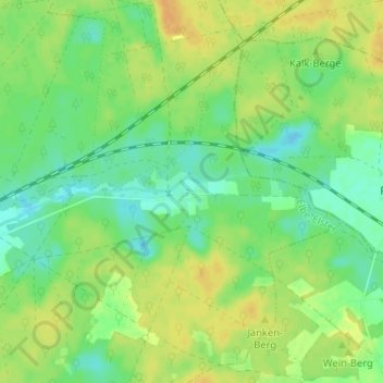
Name: Rehain topographic map, elevation, terrain.
Average elevation: 124 m
Minimum elevation: 112 m
Maximum elevation: 137 m
Thank you for supporting this site ❤️
Make a donation
Make a donation