
Thank you for supporting this site ❤️
Make a donation
Make a donation
Girdwood topographic map
Click on the map to display elevation.
Thank you for supporting this site ❤️
Make a donation
Make a donation
About this map
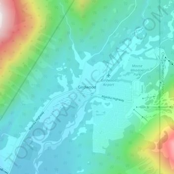
Name: Girdwood topographic map, elevation, terrain.
Location: Girdwood, Anchorage, Alaska, 99587, United States (60.94325 -149.15370 60.98325 -149.11370)
Average elevation: 181 m
Minimum elevation: 7 m
Maximum elevation: 978 m
Thank you for supporting this site ❤️
Make a donation
Make a donation
Other topographic maps
Click on a map to view its topography, its elevation and its terrain.