
Ula topographic map
Click on the map to display elevation.
About this map
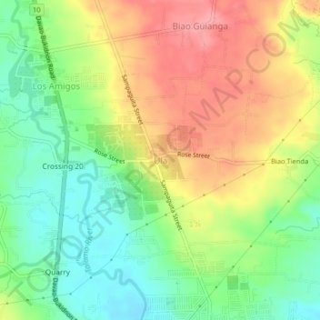
Name: Ula topographic map, elevation, terrain.
Location: Ula, Davao City, Davao Region, 8022, Philippines (7.11192 125.47277 7.15192 125.51277)
Average elevation: 185 m
Minimum elevation: 140 m
Maximum elevation: 235 m
Other topographic maps
Click on a map to view its topography, its elevation and its terrain.