
Le Rocheux topographic map
Interactive map
Click on the map to display elevation.
About this map
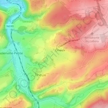
Name: Le Rocheux topographic map, elevation, terrain.
Location: Le Rocheux, Theux, Verviers, Liège, Wallonie, 4910, Belgique (50.52354 5.81189 50.56354 5.85189)
Average elevation: 248 m
Minimum elevation: 137 m
Maximum elevation: 353 m