
Thank you for supporting this site ❤️
Make a donation
Make a donation
Mount Sharp topographic map
Click on the map to display elevation.
Thank you for supporting this site ❤️
Make a donation
Make a donation
About this map
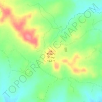
Name: Mount Sharp topographic map, elevation, terrain.
Location: Mount Sharp, Hays County, Texas, United States (30.10016 -98.21229 30.10026 -98.21219)
Average elevation: 429 m
Minimum elevation: 394 m
Maximum elevation: 481 m
Thank you for supporting this site ❤️
Make a donation
Make a donation
Other topographic maps
Click on a map to view its topography, its elevation and its terrain.