
Lede topographic map
Interactive map
Click on the map to display elevation.
About this map
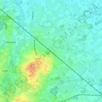
Name: Lede topographic map, elevation, terrain.
Location: Lede, Aalst, Oost-Vlaanderen, Vlaanderen, België (50.95256 3.94513 50.98717 4.02404)
Average elevation: 14 m
Minimum elevation: 5 m
Maximum elevation: 38 m