
Thank you for supporting this site ❤️
Make a donation
Make a donation
Lake Nona topographic map
Click on the map to display elevation.
Thank you for supporting this site ❤️
Make a donation
Make a donation
About this map
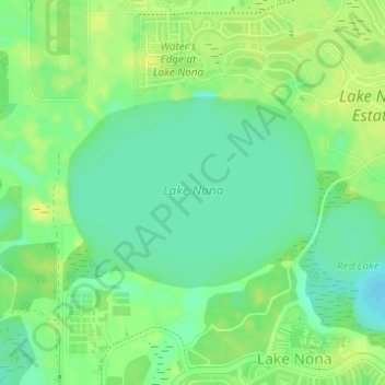
Name: Lake Nona topographic map, elevation, terrain.
Location: Lake Nona, Orlando, Orange County, Florida, United States (28.40257 -81.28204 28.41604 -81.26197)
Average elevation: 26 m
Minimum elevation: 15 m
Maximum elevation: 35 m
Thank you for supporting this site ❤️
Make a donation
Make a donation
Other topographic maps
Click on a map to view its topography, its elevation and its terrain.