
Thank you for supporting this site ❤️
Make a donation
Make a donation
Armoor topographic map
Click on the map to display elevation.
Thank you for supporting this site ❤️
Make a donation
Make a donation
Armoor
Topography and Natural Features Armoor is located in the Deccan Plateau, characterized by its rugged terrain and basalt formations, a typical feature of this volcanic plateau region. One of the most notable geographical highlights is the “Navanatha Siddeshwara Temple Hill” – a large hill that not only holds spiritual significance but also provides a scenic view of the town and its surroundings. This hilly terrain, with its rocky outcrops and vegetation, gives the area its distinctive appearance.
Thank you for supporting this site ❤️
Make a donation
Make a donation
About this map
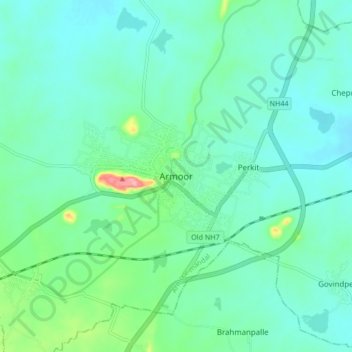
Name: Armoor topographic map, elevation, terrain.
Average elevation: 370 m
Minimum elevation: 347 m
Maximum elevation: 463 m
Thank you for supporting this site ❤️
Make a donation
Make a donation