
Thank you for supporting this site ❤️
Make a donation
Make a donation
Guanella Pass topographic map
Click on the map to display elevation.
Thank you for supporting this site ❤️
Make a donation
Make a donation
Guanella Pass
Guanella Pass (elevation 11,669 ft or 3,557 m) is a high mountain pass in central Colorado, in the Rocky Mountains of the western United States.
Thank you for supporting this site ❤️
Make a donation
Make a donation
About this map
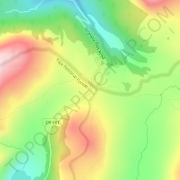
Name: Guanella Pass topographic map, elevation, terrain.
Location: Guanella Pass, Clear Creek County, Colorado, United States (39.59484 -105.71116 39.59494 -105.71106)
Average elevation: 3,526 m
Minimum elevation: 3,348 m
Maximum elevation: 3,740 m
Thank you for supporting this site ❤️
Make a donation
Make a donation
Other topographic maps
Click on a map to view its topography, its elevation and its terrain.