
Thank you for supporting this site ❤️
Make a donation
Make a donation
Ooigem topographic map
Click on the map to display elevation.
Thank you for supporting this site ❤️
Make a donation
Make a donation
Ooigem
Ooigem ligt in Zandlemig Vlaanderen en in de vallei van de Leie. De hoogte bedraagt 10-22 meter. Ten noorden van Ooigem mondt het Kanaal Roeselare-Leie uit in de Leie. De twee oude Leie-armen, respectievelijk achter het kasteel en op de grens met Bavikhove, zijn getuigen van de meanderende Leie zoals die tot in 1974 bestond. Het Ooigembos is een belangrijk natuurgebied.
Thank you for supporting this site ❤️
Make a donation
Make a donation
About this map
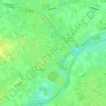
Name: Ooigem topographic map, elevation, terrain.
Location: Ooigem, Wielsbeke, Tielt, West-Vlaanderen, 8710, België (50.88039 3.31017 50.90962 3.34677)
Average elevation: 14 m
Minimum elevation: 4 m
Maximum elevation: 23 m
Thank you for supporting this site ❤️
Make a donation
Make a donation
Other topographic maps
Click on a map to view its topography, its elevation and its terrain.