
Thank you for supporting this site ❤️
Make a donation
Make a donation
Toddville topographic map
Click on the map to display elevation.
Thank you for supporting this site ❤️
Make a donation
Make a donation
About this map
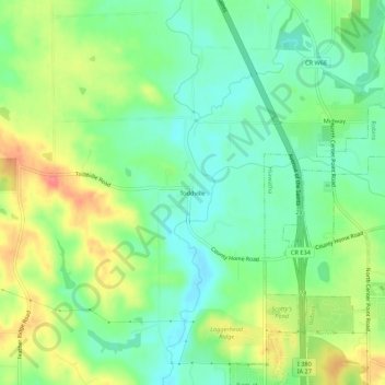
Name: Toddville topographic map, elevation, terrain.
Location: Toddville, Linn County, Iowa, 52341, United States (42.07860 -91.73675 42.11860 -91.69675)
Average elevation: 254 m
Minimum elevation: 227 m
Maximum elevation: 296 m
Thank you for supporting this site ❤️
Make a donation
Make a donation
Other topographic maps
Click on a map to view its topography, its elevation and its terrain.
Thank you for supporting this site ❤️
Make a donation
Make a donation
Thank you for supporting this site ❤️
Make a donation
Make a donation