
Thank you for supporting this site ❤️
Make a donation
Make a donation
Lampasas topographic map
Click on the map to display elevation.
Thank you for supporting this site ❤️
Make a donation
Make a donation
About this map
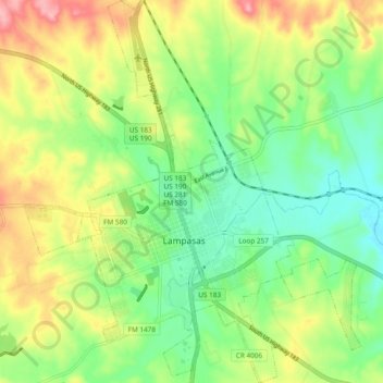
Name: Lampasas topographic map, elevation, terrain.
Location: Lampasas, Lampasas County, Texas, 76550, USA (31.03415 -98.22336 31.11538 -98.13958)
Average elevation: 339 m
Minimum elevation: 293 m
Maximum elevation: 407 m
Thank you for supporting this site ❤️
Make a donation
Make a donation