
Thank you for supporting this site ❤️
Make a donation
Make a donation
Deng topographic map
Click on the map to display elevation.
Thank you for supporting this site ❤️
Make a donation
Make a donation
About this map
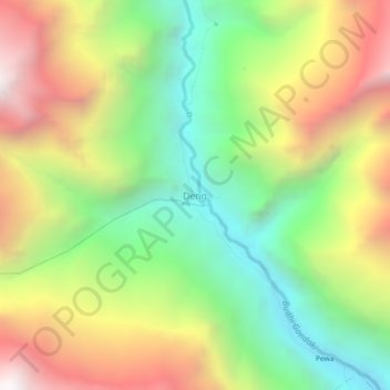
Name: Deng topographic map, elevation, terrain.
Location: Deng, Chum Nubri, Gorkha, Gandaki Province, Nepal (28.45941 84.84726 28.49941 84.88726)
Average elevation: 2,569 m
Minimum elevation: 1,690 m
Maximum elevation: 3,698 m
Thank you for supporting this site ❤️
Make a donation
Make a donation
Other topographic maps
Click on a map to view its topography, its elevation and its terrain.