
说日 topographic map
Interactive map
Click on the map to display elevation.
About this map
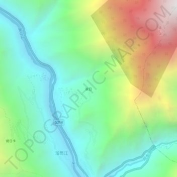
Name: 说日 topographic map, elevation, terrain.
Location: 说日, 佛山乡, 德钦县, 迪庆藏族自治州, 云南省, 中国 (28.55035 98.77254 28.59035 98.81254)
Average elevation: 2,726 m
Minimum elevation: 2,056 m
Maximum elevation: 4,146 m