
Thank you for supporting this site ❤️
Make a donation
Make a donation
Bleibtreusee topographic map
Click on the map to display elevation.
Thank you for supporting this site ❤️
Make a donation
Make a donation
About this map
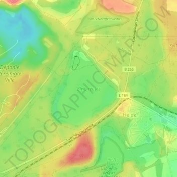
Name: Bleibtreusee topographic map, elevation, terrain.
Average elevation: 106 m
Minimum elevation: 74 m
Maximum elevation: 136 m
Thank you for supporting this site ❤️
Make a donation
Make a donation
Other topographic maps
Click on a map to view its topography, its elevation and its terrain.
Geildorf
Deutschland > Nordrhein-Westfalen > Rhein-Erft-Kreis > Brühl > Geildorf
Average elevation: 92 m
Thank you for supporting this site ❤️
Make a donation
Make a donation