
Thank you for supporting this site ❤️
Make a donation
Make a donation
Rheinstetten topographic map
Click on the map to display elevation.
Thank you for supporting this site ❤️
Make a donation
Make a donation
About this map
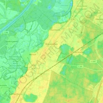
Name: Rheinstetten topographic map, elevation, terrain.
Average elevation: 113 m
Minimum elevation: 101 m
Maximum elevation: 123 m
Thank you for supporting this site ❤️
Make a donation
Make a donation
Other topographic maps
Click on a map to view its topography, its elevation and its terrain.
Östringen
Deutschland > Baden-Württemberg > Landkreis Karlsruhe > Östringen > Östringen
Average elevation: 177 m
Justizvollzugsanstalt Bruchsal - Außenstelle Kislau
Deutschland > Baden-Württemberg > Landkreis Karlsruhe > Bad Schönborn
Average elevation: 116 m
Thank you for supporting this site ❤️
Make a donation
Make a donation