
Thank you for supporting this site ❤️
Make a donation
Make a donation
Pinyon Pines topographic map
Click on the map to display elevation.
Thank you for supporting this site ❤️
Make a donation
Make a donation
Pinyon Pines
It is located in a small valley between the San Jacinto Mountains and Santa Rosa Mountains, north of State Route 74. It takes its name from the Pinyon pine (Pinus monophylla) trees native to the area. Pinyon Pines sits at an elevation of approximately 4000 feet.
Thank you for supporting this site ❤️
Make a donation
Make a donation
About this map
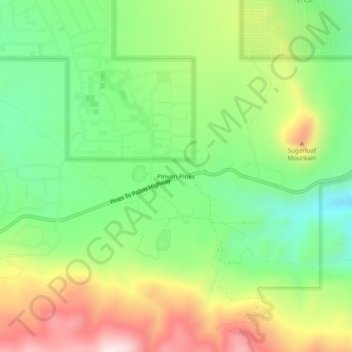
Name: Pinyon Pines topographic map, elevation, terrain.
Average elevation: 1,276 m
Minimum elevation: 1,040 m
Maximum elevation: 1,621 m
Thank you for supporting this site ❤️
Make a donation
Make a donation