
Thank you for supporting this site ❤️
Make a donation
Make a donation
FELDA Chuping topographic map
Click on the map to display elevation.
Thank you for supporting this site ❤️
Make a donation
Make a donation
About this map
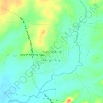
Name: FELDA Chuping topographic map, elevation, terrain.
Location: FELDA Chuping, Perlis, Malaysia (6.47344 100.31933 6.51344 100.35933)
Average elevation: 36 m
Minimum elevation: 18 m
Maximum elevation: 75 m
Thank you for supporting this site ❤️
Make a donation
Make a donation
Other topographic maps
Click on a map to view its topography, its elevation and its terrain.