
Thank you for supporting this site ❤️
Make a donation
Make a donation
Fiães do Tâmega topographic map
Click on the map to display elevation.
Thank you for supporting this site ❤️
Make a donation
Make a donation
About this map
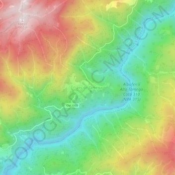
Name: Fiães do Tâmega topographic map, elevation, terrain.
Location: Fiães do Tâmega, Boticas, Vila Real, Norte, Portugal (41.59083 -7.70456 41.63083 -7.66456)
Average elevation: 558 m
Minimum elevation: 247 m
Maximum elevation: 987 m
Thank you for supporting this site ❤️
Make a donation
Make a donation