
Thank you for supporting this site ❤️
Make a donation
Make a donation
Magness topographic map
Click on the map to display elevation.
Thank you for supporting this site ❤️
Make a donation
Make a donation
About this map
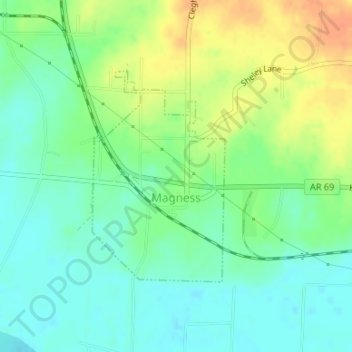
Name: Magness topographic map, elevation, terrain.
Location: Magness, Independence County, Arkansas, 72553, United States (35.69579 -91.48834 35.71201 -91.47577)
Average elevation: 85 m
Minimum elevation: 69 m
Maximum elevation: 108 m
Thank you for supporting this site ❤️
Make a donation
Make a donation
Other topographic maps
Click on a map to view its topography, its elevation and its terrain.
Thank you for supporting this site ❤️
Make a donation
Make a donation
Thank you for supporting this site ❤️
Make a donation
Make a donation
Thank you for supporting this site ❤️
Make a donation
Make a donation
Bryant Woodland Heights
United States > Arkansas > Independence County > Batesville
Average elevation: 107 m
Thank you for supporting this site ❤️
Make a donation
Make a donation
Quail Valley
United States > Arkansas > Independence County > Batesville > Quail Valley
Average elevation: 110 m
Thank you for supporting this site ❤️
Make a donation
Make a donation