
Thank you for supporting this site ❤️
Make a donation
Make a donation
Irrhausen topographic map
Click on the map to display elevation.
Thank you for supporting this site ❤️
Make a donation
Make a donation
About this map
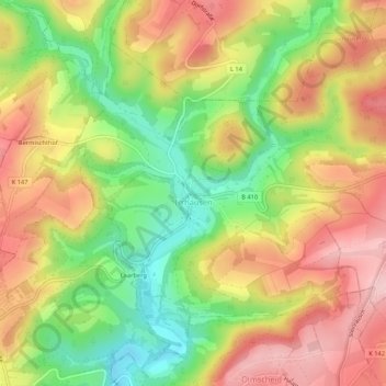
Name: Irrhausen topographic map, elevation, terrain.
Average elevation: 443 m
Minimum elevation: 340 m
Maximum elevation: 536 m
Thank you for supporting this site ❤️
Make a donation
Make a donation
Other topographic maps
Click on a map to view its topography, its elevation and its terrain.
Heckhalenfeld
Deutschland > Rheinland-Pfalz > Eifelkreis Bitburg-Prüm > Winterspelt
Average elevation: 480 m
Schweiler
Deutschland > Rheinland-Pfalz > Eifelkreis Bitburg-Prüm > Mützenich
Average elevation: 498 m
Thank you for supporting this site ❤️
Make a donation
Make a donation