
Thank you for supporting this site ❤️
Make a donation
Make a donation
Neals Run topographic map
Click on the map to display elevation.
Thank you for supporting this site ❤️
Make a donation
Make a donation
About this map
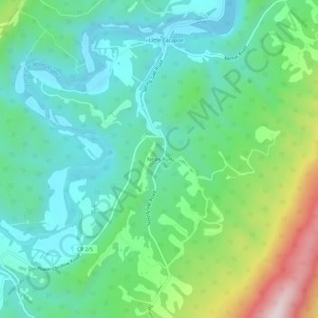
Name: Neals Run topographic map, elevation, terrain.
Location: Neals Run, Hampshire County, West Virginia, United States (39.46343 -78.51640 39.50343 -78.47640)
Average elevation: 292 m
Minimum elevation: 161 m
Maximum elevation: 645 m
Thank you for supporting this site ❤️
Make a donation
Make a donation
Other topographic maps
Click on a map to view its topography, its elevation and its terrain.