
Thank you for supporting this site ❤️
Make a donation
Make a donation
Dorcas topographic map
Click on the map to display elevation.
Thank you for supporting this site ❤️
Make a donation
Make a donation
About this map
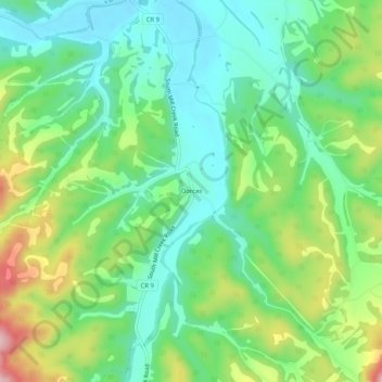
Name: Dorcas topographic map, elevation, terrain.
Location: Dorcas, Grant County, West Virginia, United States (38.91900 -79.12615 38.95900 -79.08615)
Average elevation: 354 m
Minimum elevation: 281 m
Maximum elevation: 502 m
Thank you for supporting this site ❤️
Make a donation
Make a donation
Other topographic maps
Click on a map to view its topography, its elevation and its terrain.