Geolocate

Plate Mesa topographic map

Interactive map

Click on the map to display elevation.

About this map

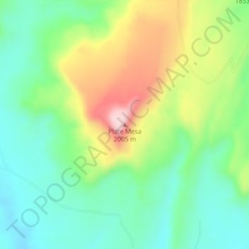
Name: Plate Mesa topographic map, elevation, terrain.

Location: Plate Mesa, Bernalillo County, New Mexico, USA (35.14277 -107.13426 35.14287 -107.13416)

Average elevation: 1,845 m

Minimum elevation: 1,752 m

Maximum elevation: 2,013 m

Other topographic maps

Click on a map to view its topography, its elevation and its terrain.

Angel Fire

USA > New Mexico > Angel Fire

Average elevation: 2,786 m

Truchas Peak

USA > New Mexico

Average elevation: 3,639 m

Sacramento

USA > New Mexico > Sacramento

Average elevation: 2,320 m

Farmington

USA > New Mexico > Farmington

Average elevation: 1,698 m

El Rancho

USA > New Mexico > El Rancho

Average elevation: 1,743 m

Manzano Mountains

USA > New Mexico > D Candelaria Place

Average elevation: 2,211 m

Bernalillo County

USA > New Mexico

Average elevation: 1,808 m

Taos County

USA > New Mexico

Average elevation: 2,561 m