
Thank you for supporting this site ❤️
Make a donation
Make a donation
The Three Peaks topographic map
Click on the map to display elevation.
Thank you for supporting this site ❤️
Make a donation
Make a donation
About this map
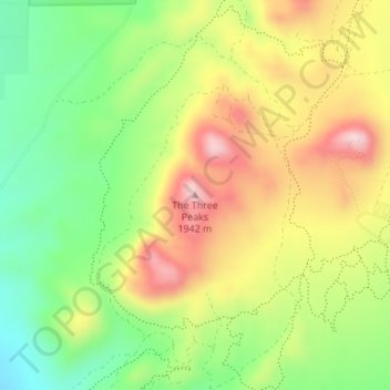
Name: The Three Peaks topographic map, elevation, terrain.
Location: The Three Peaks, Iron County, Utah, United States (37.76104 -113.20250 37.76114 -113.20240)
Average elevation: 1,789 m
Minimum elevation: 1,653 m
Maximum elevation: 1,944 m
Thank you for supporting this site ❤️
Make a donation
Make a donation
Other topographic maps
Click on a map to view its topography, its elevation and its terrain.