
Tchaourou topographic map
Interactive map
Click on the map to display elevation.
About this map
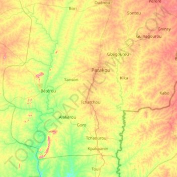
Name: Tchaourou topographic map, elevation, terrain.
Location: Tchaourou, Borgou, Benin (8.76064 1.96972 9.67351 3.15787)
Average elevation: 327 m
Minimum elevation: 195 m
Maximum elevation: 589 m
Other topographic maps
Click on a map to view its topography, its elevation and its terrain.