
Thank you for supporting this site ❤️
Make a donation
Make a donation
Arjunchaupari topographic map
Click on the map to display elevation.
Thank you for supporting this site ❤️
Make a donation
Make a donation
About this map
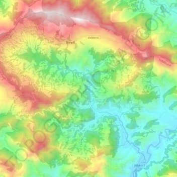
Name: Arjunchaupari topographic map, elevation, terrain.
Location: Arjunchaupari, Syangja, Gandaki Pradesh, Nepal (28.06163 83.70302 28.14869 83.81787)
Average elevation: 1,336 m
Minimum elevation: 748 m
Maximum elevation: 2,227 m
Thank you for supporting this site ❤️
Make a donation
Make a donation
Other topographic maps
Click on a map to view its topography, its elevation and its terrain.