
Thank you for supporting this site ❤️
Make a donation
Make a donation
Bhirkot topographic map
Click on the map to display elevation.
Thank you for supporting this site ❤️
Make a donation
Make a donation
About this map
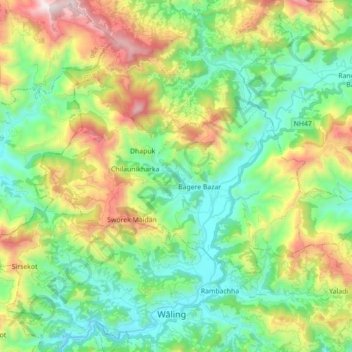
Name: Bhirkot topographic map, elevation, terrain.
Location: Bhirkot, Syangja, Gandaki Pradesh, Nepal (27.99906 83.69299 28.08602 83.86846)
Average elevation: 1,123 m
Minimum elevation: 682 m
Maximum elevation: 2,059 m
Thank you for supporting this site ❤️
Make a donation
Make a donation
Other topographic maps
Click on a map to view its topography, its elevation and its terrain.